Via Alpina 1 - Switzerland
Self-Guided Walking Holiday
Holiday Type:
Hut to Hut
When:
July to Mid-Sept
Start:
Sargans, Switzerland
Finish:
Montreux, Switzerland
Distance:
386km (240 miles)
Length:
7 to 23 days days
Grade:
Moderate
2026 Price:
from £ 1,870.00
✔
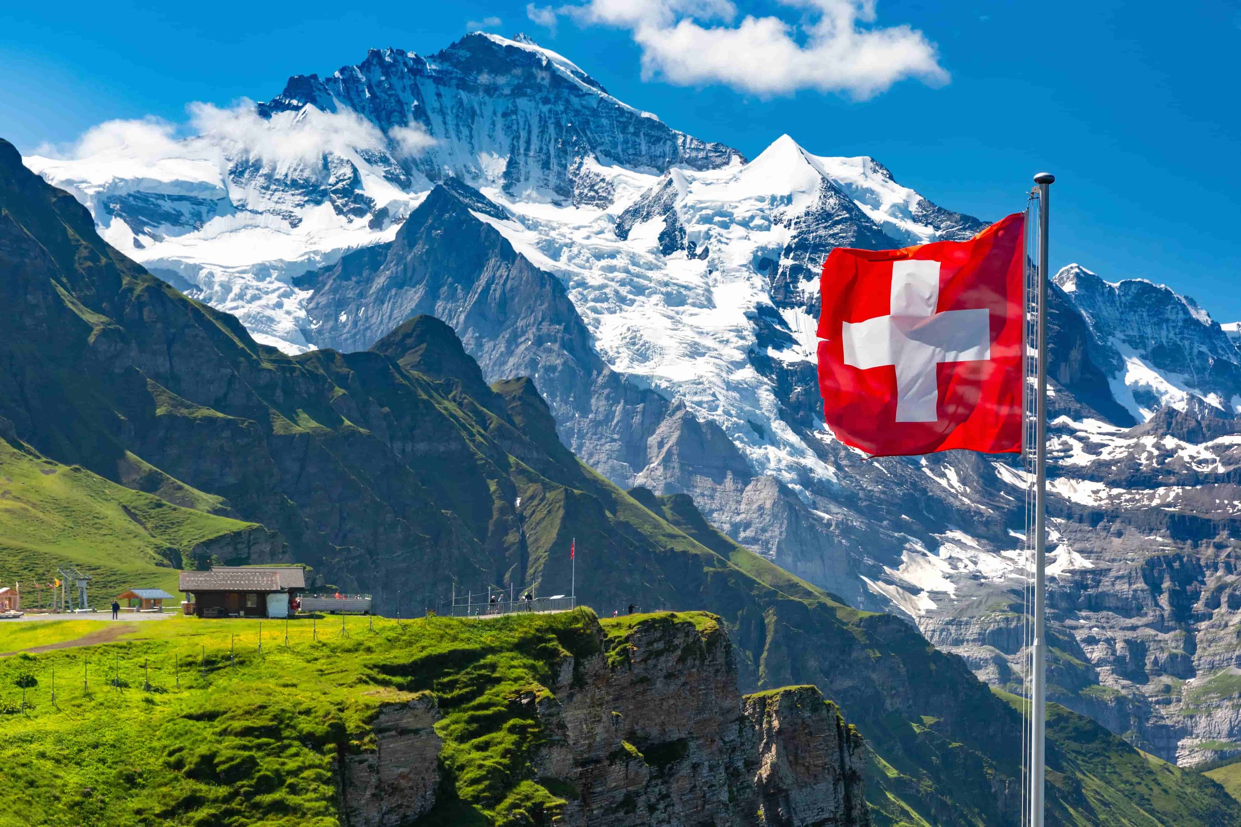
Wander through the stunning Bernese Oberland
✔
Stay in comfort each night in charming Swiss villages
✔
Walk alongside magnificent peaks such as the Eiger and Jungfrau
✔
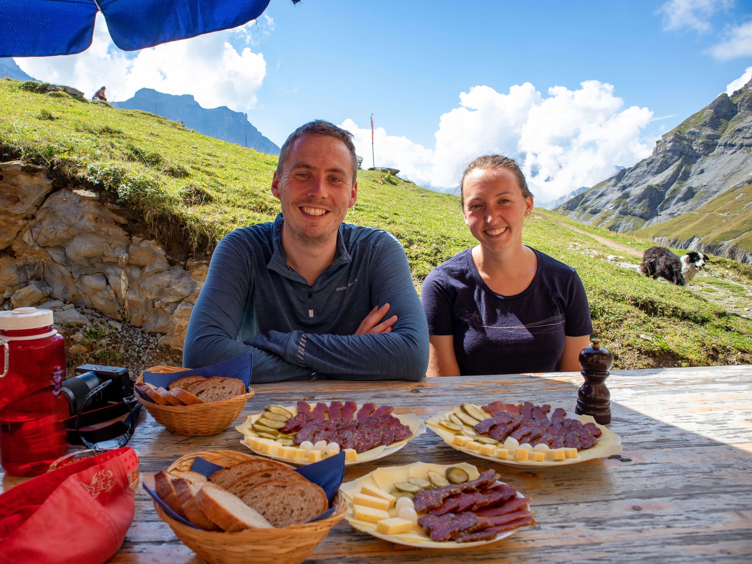
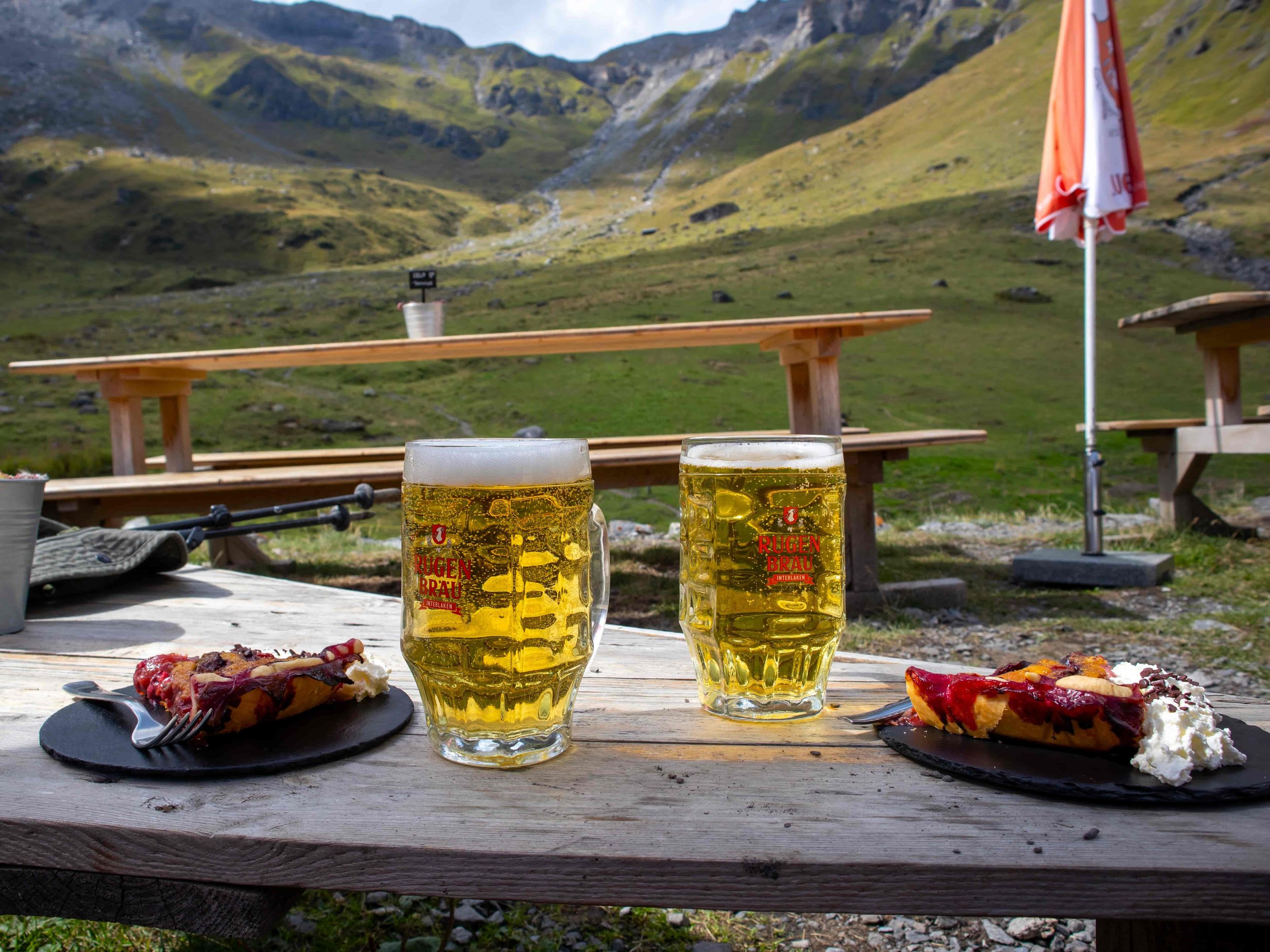
Enjoy fantastic Swiss cuisine like raclette and roesti
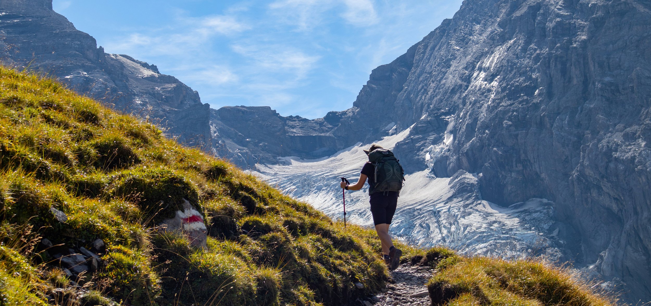
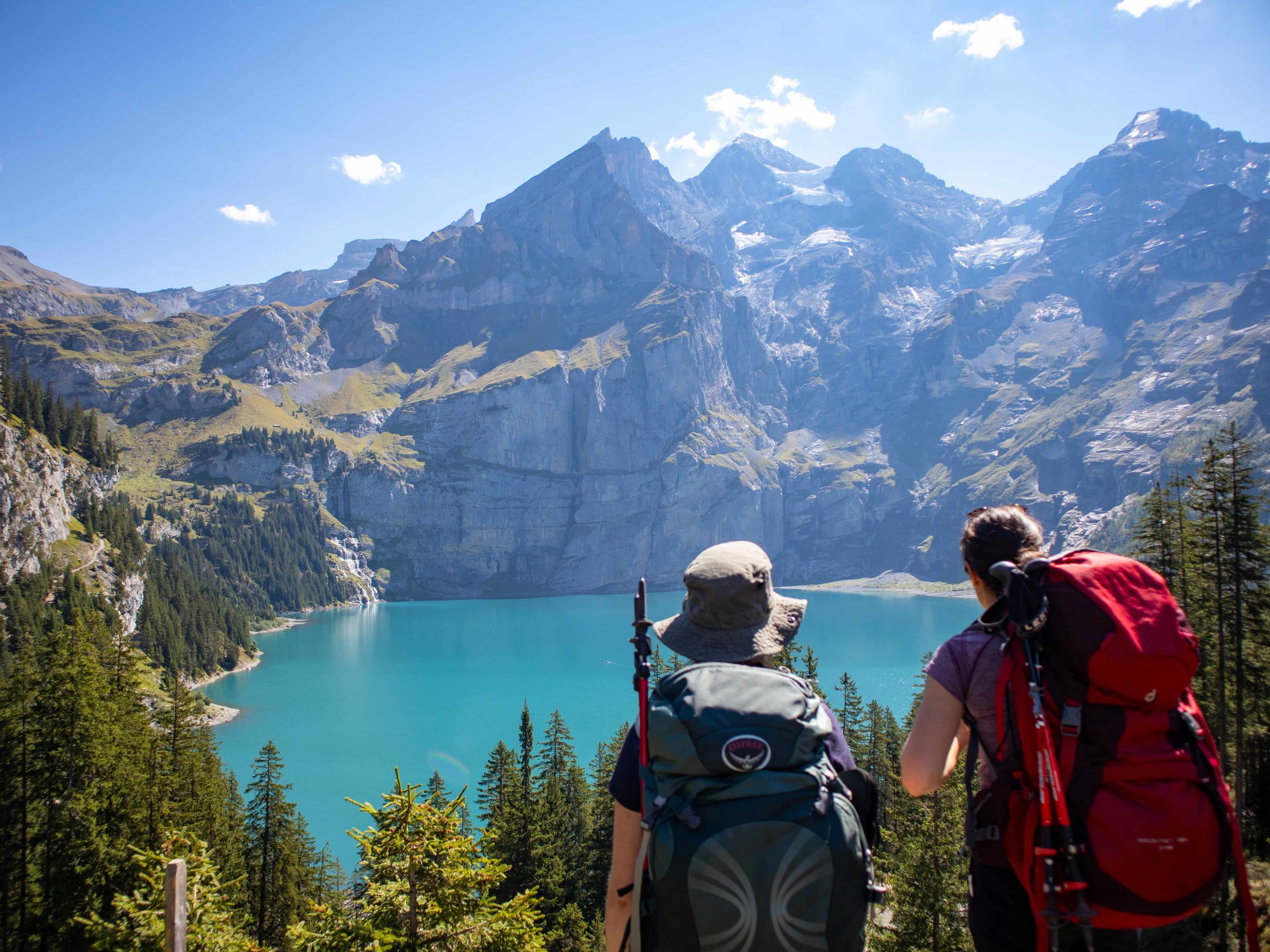
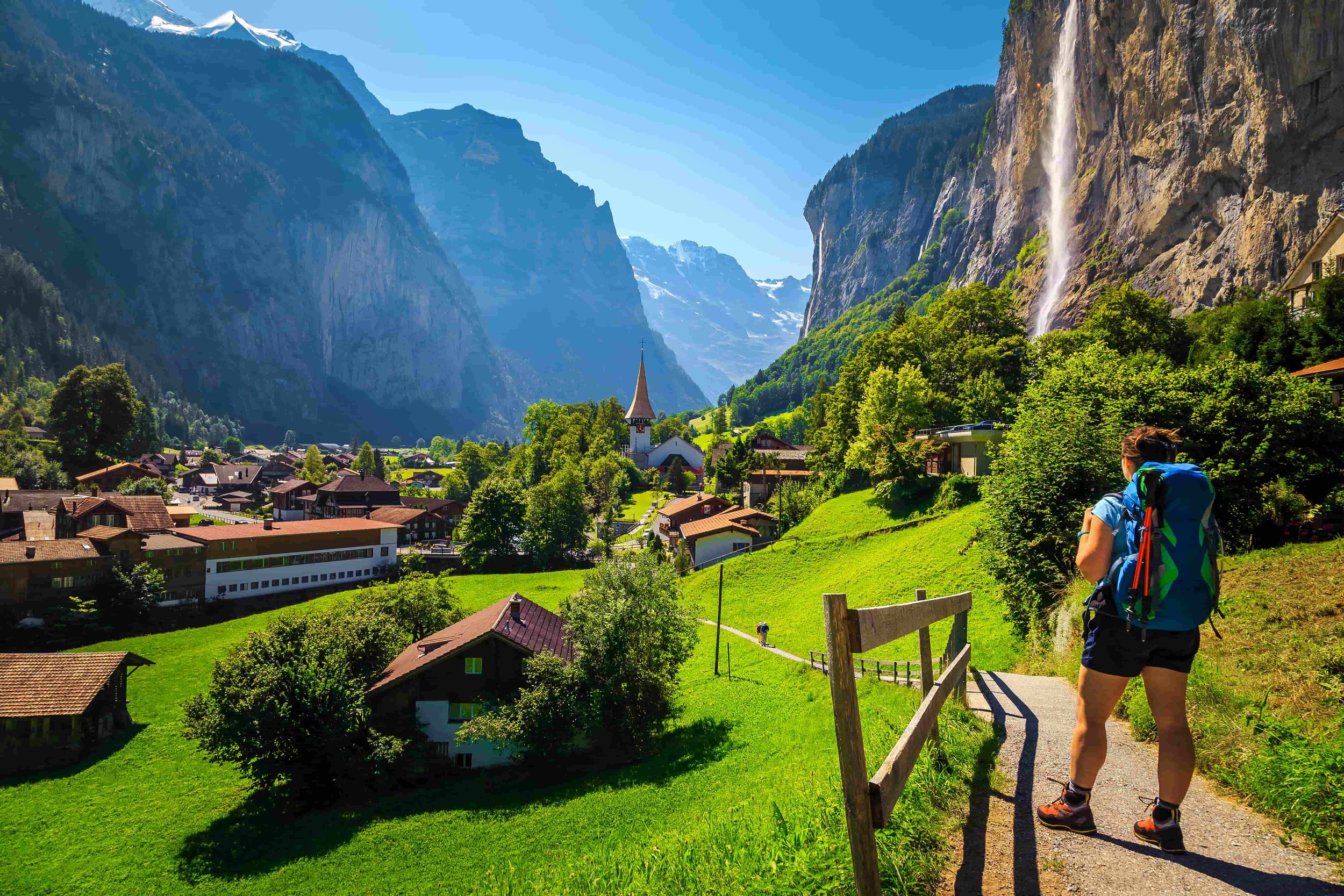
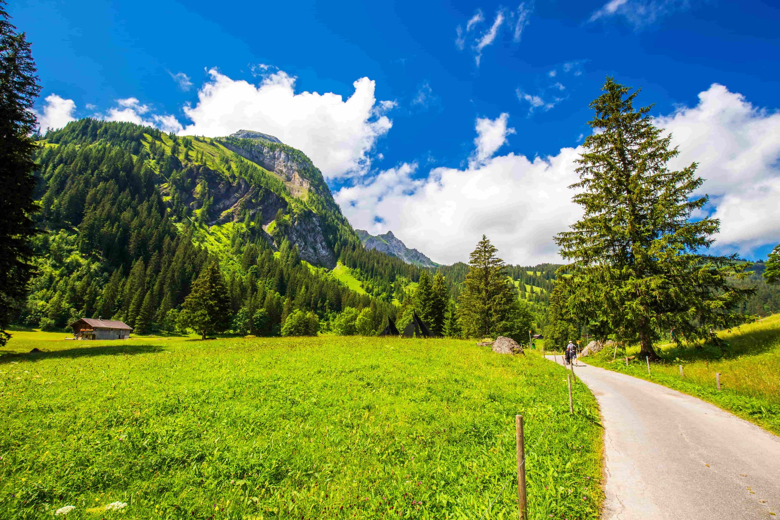
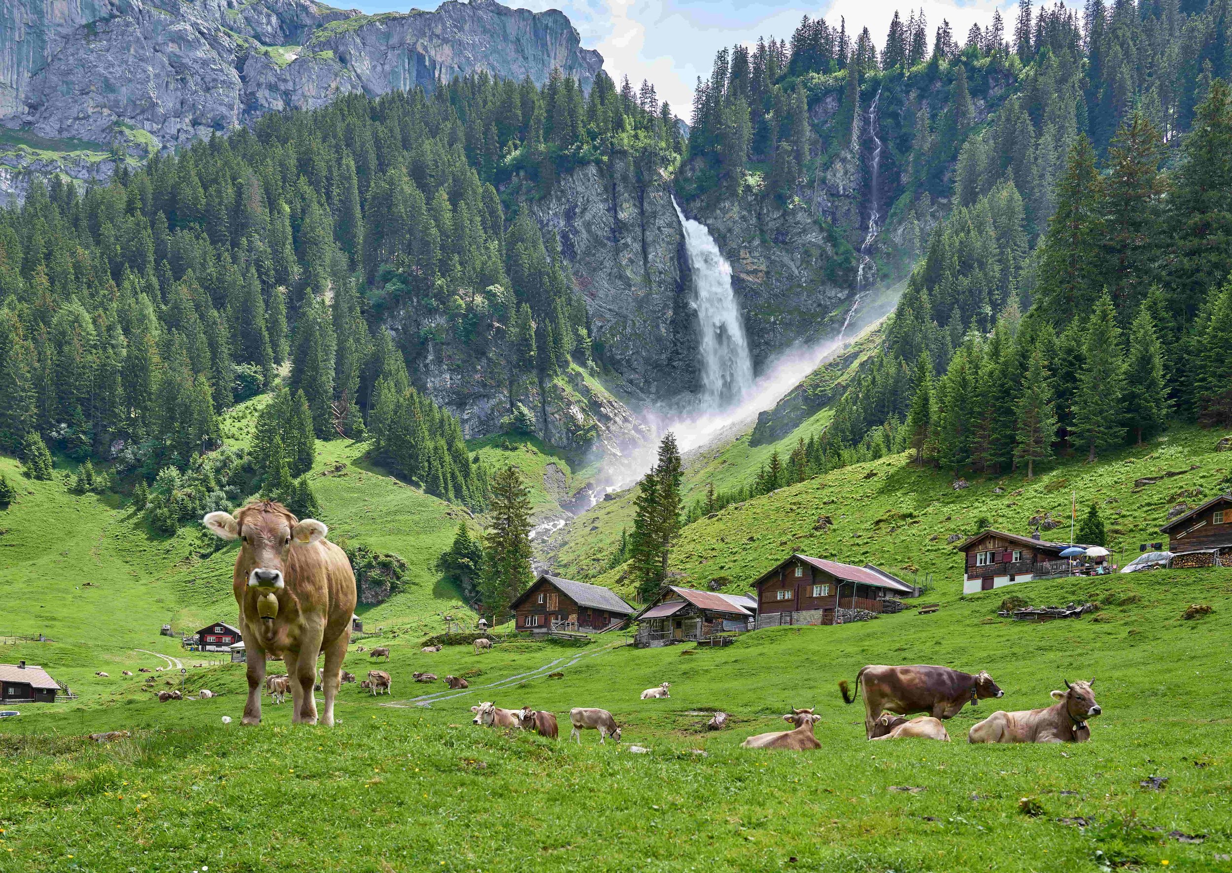
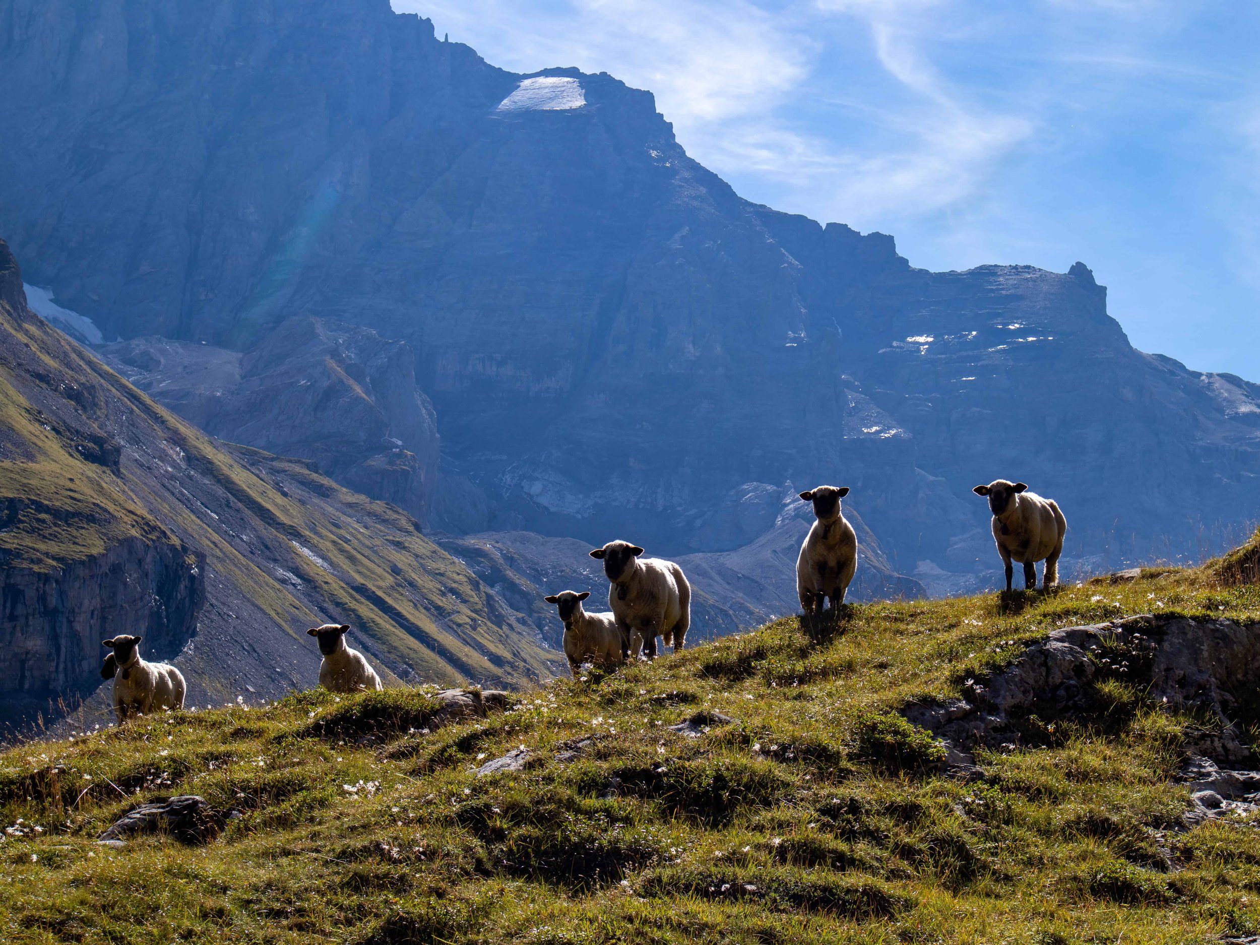
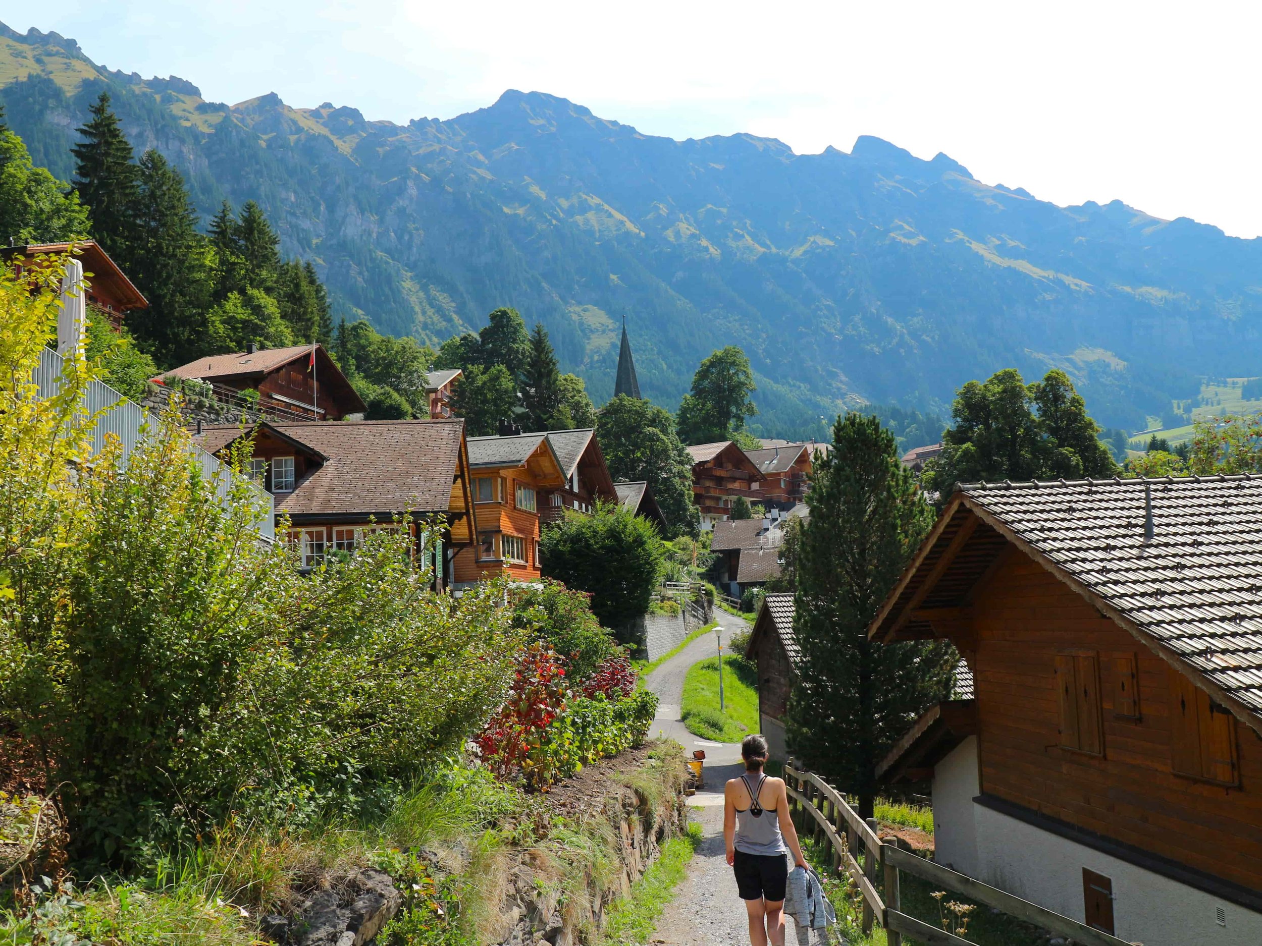
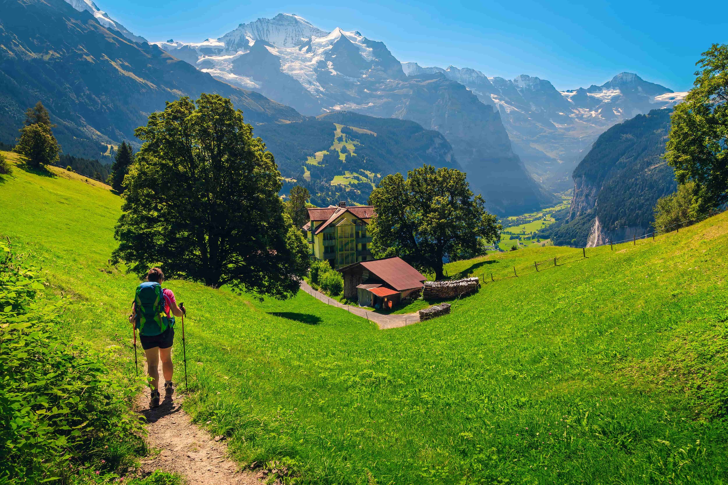
The Via Alpina 1 takes in some of the very best of the Swiss Alps and delves into truly chocolate box Switzerland. Traversing the width of the country, hikers conquer numerous mountain passes and cut through countless Alpine pastures filled with the sound of cowbells. Our most popular section of the route runs through the spectacular Bernese Oberland, where hikers walk in the shadow of famous mountains such as the Eiger and Jungfrau, and visit the quintessential car-free villages of Wengen and Mürren.
Formerly known as the Swiss Alpine Pass Route, the trail has grown in popularity and infrastructure in recent years. Unlike many Alpine treks, the Via Alpina does not require any hut stays, allowing for greater comfort and flexibility. For those short on time, we offer selected highlights itineraries below.
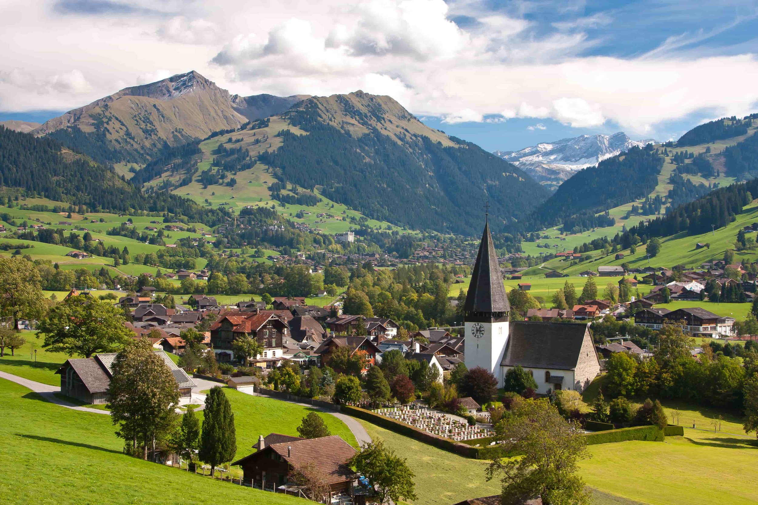
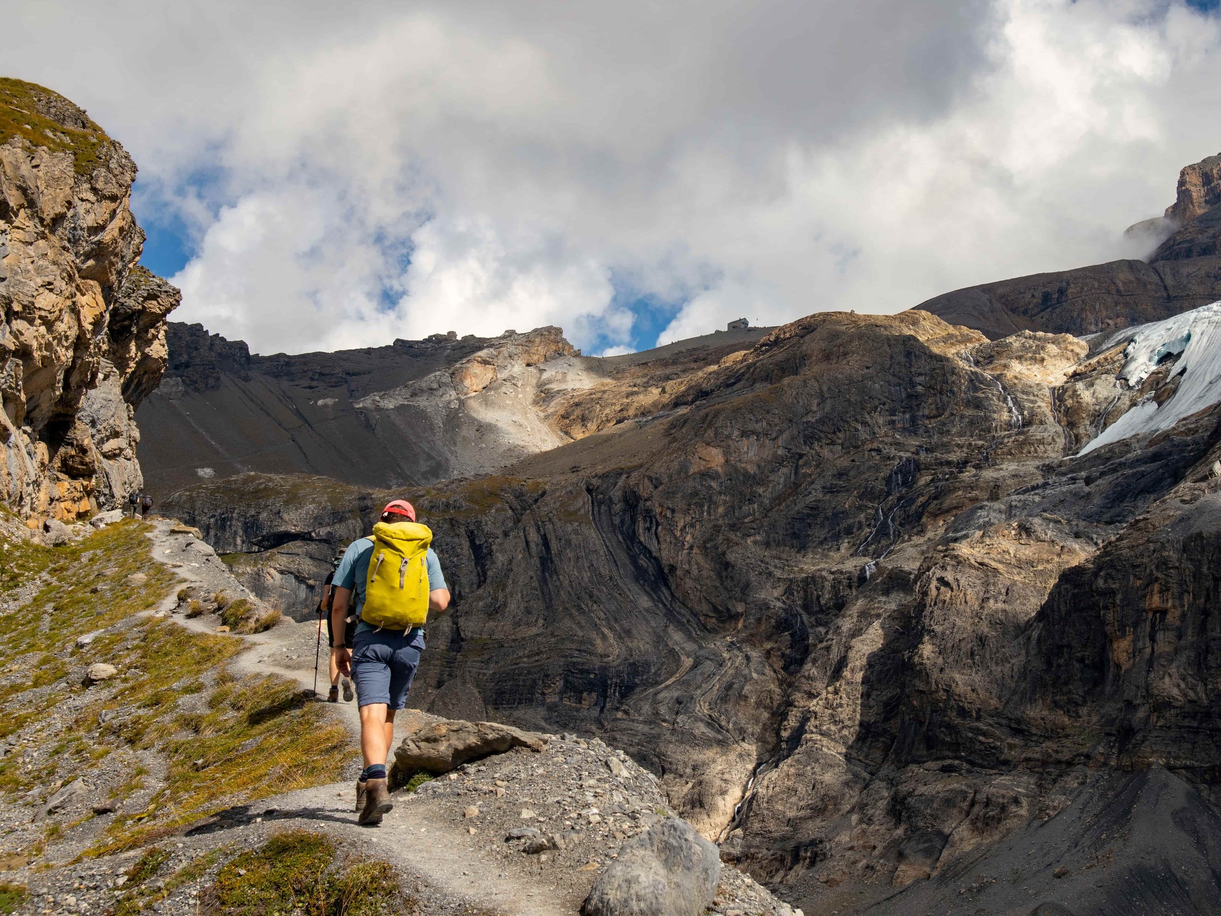
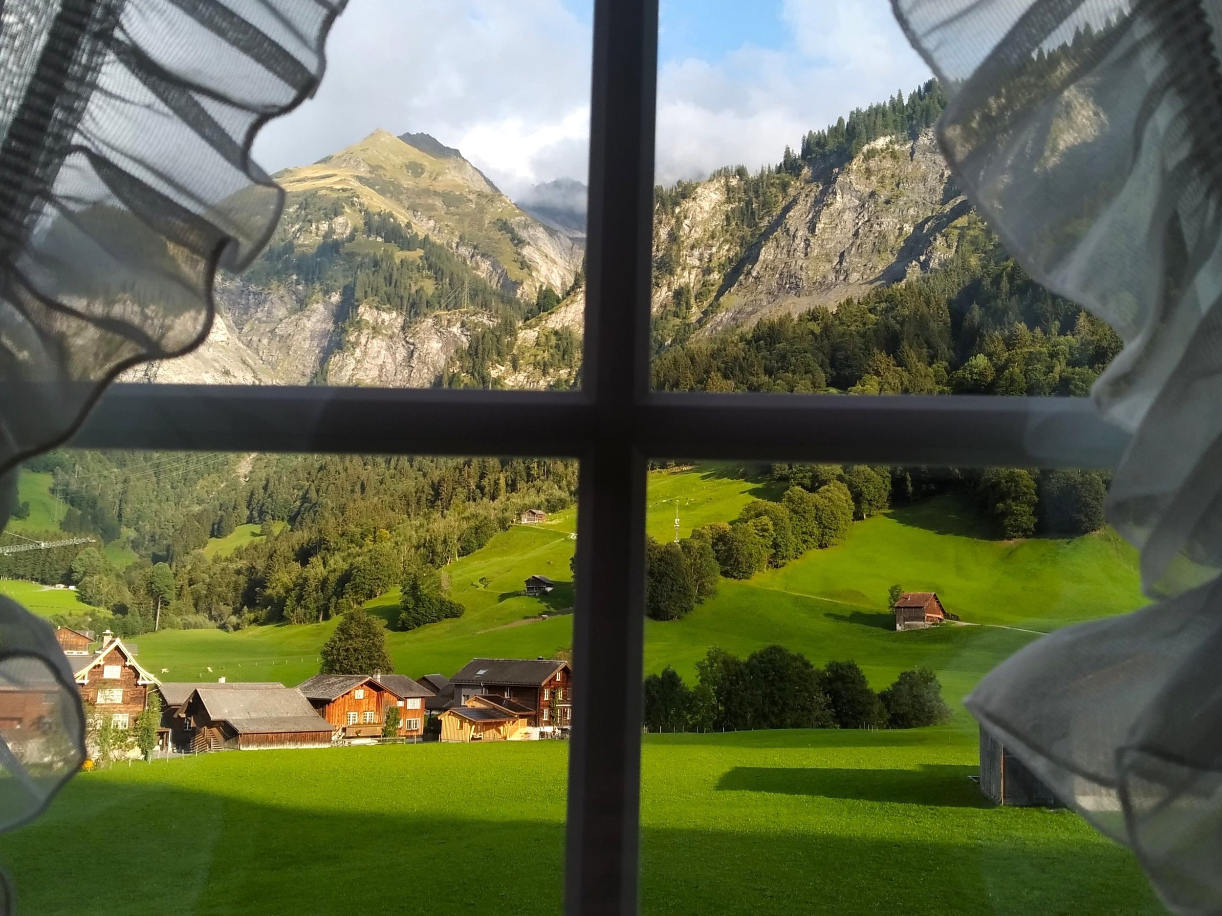
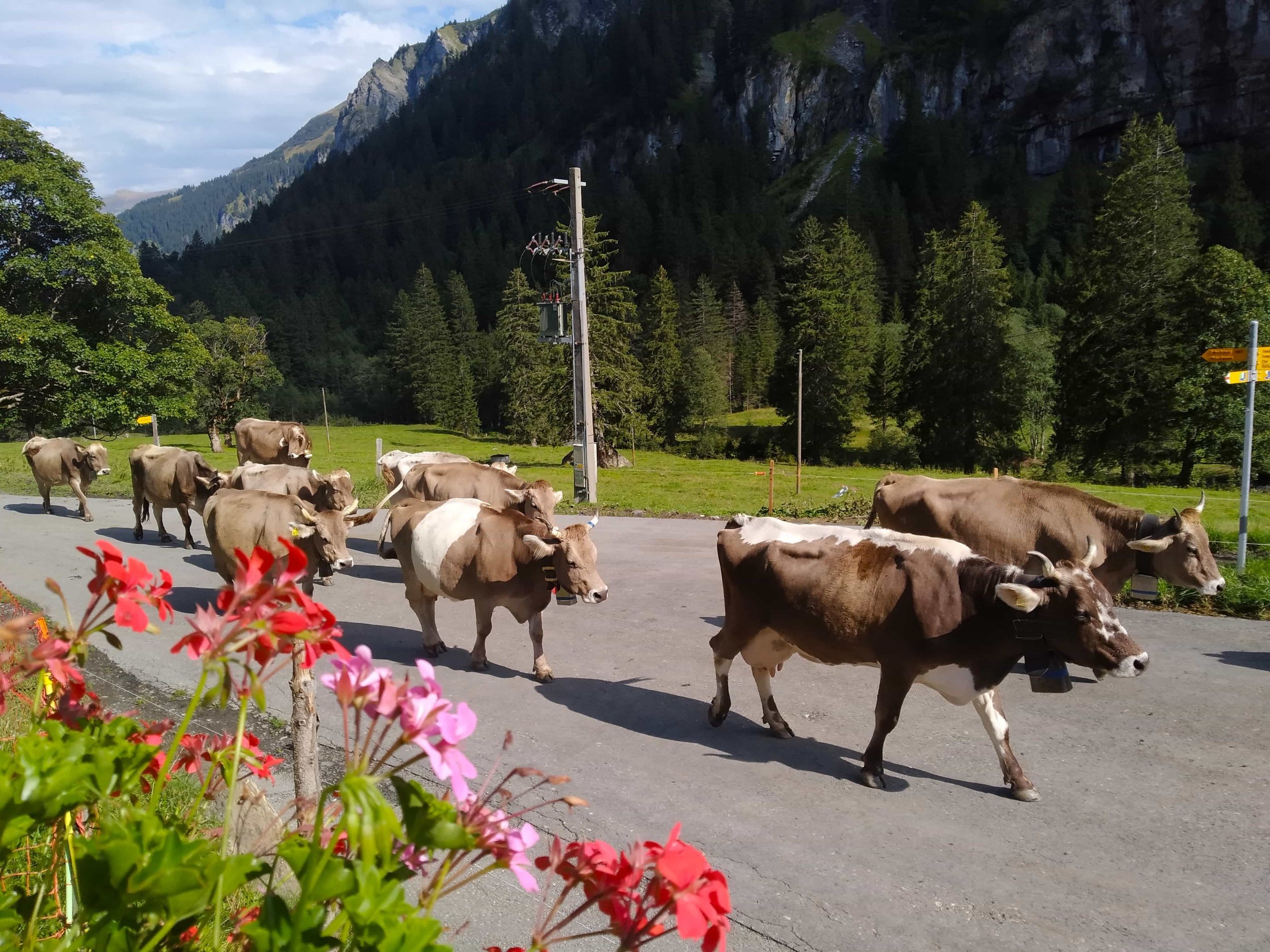
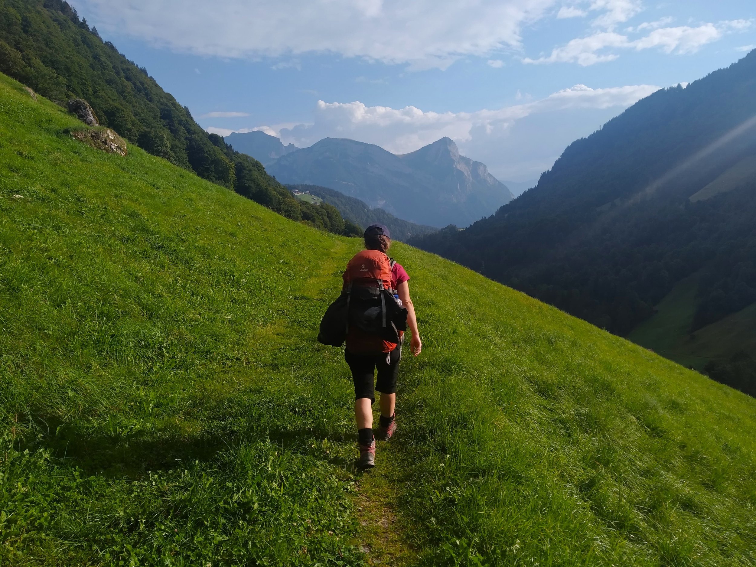
Photo Gallery
Via Alpina 1 Itinerary & Price Options
We offer three suggested itineraries on the Via Alpina 1, which are set out below. However, we are also happy to create a tailor-made itinerary based on your preferences - please just get in touch. From solo walkers to groups of friends, we are happy to help with all requirements.
VAS-1 Itinerary
Length: 18 Days / 17 nights
Difficulty: Moderate
Price: from £ 2,840.00 per person (GBP)
▼ Find out more...
2026 Prices in GBP (for 2 persons sharing a room)Classic: £ 2,840.00 per person
Comfort: £ 4,620.00 per person
2026 Prices in GBP (for 1 person)
Classic: £ 3,690.00 per person
Comfort: £ 5,570.00 per person
Please see accommodation section below for details on our different accommodation levels.
ItineraryDay 1
Arrive Sargans
▼
Day 2
Sargans to Weistannen
12.5km & 680m ascent (8 miles & 2230ft)
▼
Day 3
Weisstannen to Elm
24km & 1300m ascent (15 miles & 4265ft)
▼
Day 4
Elm to Linthal
24.5km & 1490m ascent (15 miles & 4890ft)
▼
Day 5
Linthal to Urnerboden
17.5km & 1010m ascent (11 miles & 3310ft)
▼
Day 6
Urnerboden to Altdorf
26km & 700m ascent (16 miles & 2300ft)
▼
Day 7
Altdorf to Engelberg (via Gondola)
21.5km & 805m ascent (13.5 miles & 2640ft)
▼
Day 8
Engelberg to Meiringen (with cable car)
21.5km & 0m ascent (13.5 miles & 0ft)
▼
Day 9
Meiringen to Grindelwald
23km & 1410m ascent (14.5 miles & 4625ft)
▼
Day 10
Grindelwald to Lauterbrunnen
19km & 1100m ascent (12 miles & 3610ft)
▼
Day 11
Lauterbrunnen to Griesalp
24km & 1850m ascent (15 miles & 6070ft)
▼
Day 12
Griesalp to Kandersteg
18.5km & 1450m ascent (11.5 miles & 4755ft)
▼
Day 13
Kandersteg to Adelboden
16.5km & 1300m ascent (10 miles & 4265ft)
▼
Day 14
Adelboden to Lenk
15km & 710m ascent (9.5 miles & 2330ft)
▼
Day 15
Lenk to Gstaad
22km & 1050m ascent (13.5 miles & 3445ft)
▼
Day 16
Gstaad to L'Etivaz
16km & 1150m ascent (10 miles & 3770ft)
▼
Day 17
L'Etivaz to Rochers de Naye, train to Montreux
24km & 1680m ascent (15 miles & 5510ft)
▼
Day 18
Depart Montreux
VAS-2 Itinerary
Length: 20 Days / 19 nights
Difficulty: Moderate
Price: from £ 3,250.00 per person (GBP)
▼ Find out more...
2026 Prices in GBP (for 2 persons sharing a room)Classic: £ 3,250.00 per person
Comfort: £ 5,280.00 per person
2026 Prices in GBP (for 1 person)
Classic: £ 4,620.00 per person
Comfort: £ 6,740.00 per person
Please see accommodation section below for details on our different accommodation levels.
Day 1
Arrive Sargans
▼
Day 2
Sargans to Weistannen
12.5km & 680m ascent (8 miles & 2230ft)
▼
Day 3
Weisstannen to Elm
24km & 1300m ascent (15 miles & 4265ft)
▼
Day 4
Elm to Linthal
24.5km & 1490m ascent (15 miles & 4890ft)
▼
Day 5
Linthal to Urnerboden
17.5km & 1010m ascent (11 miles & 3310ft)
▼
Day 6
Urnerboden to Altdorf
26km & 700m ascent (16 miles & 2300ft)
▼
Day 7
Altdorf to Engelberg
29km & 1900m ascent (18 miles & 6230ft)
▼
Day 8
Engelberg to Engstlenalp
14km & 1230m ascent (8.5 miles & 4035ft)
▼
Day 9
Engstlenalp to Meiringen
20km & 640m ascent (12.5 miles & 2100ft)
▼
Day 10
Meiringen to Grindelwald
23km & 1410m ascent (14.5 miles & 4625ft)
▼
Day 11
Grindelwald to Wengen
18.5km & 1170m ascent (11.5 miles & 3840ft)
▼
Day 12
Wengen to Mürren
8.5km & 860m ascent (5.5 miles & 2820ft)
▼
Day 13
Mürren to Griesalp
17km & 1100m ascent (10.5 miles & 3610ft)
▼
Day 14
Griesalp to Kandersteg
18.5km & 1450m ascent (11.5 miles & 4755ft)
▼
Day 15
Kandersteg to Adelboden
16.5km & 1300m ascent (10 miles & 4265ft)
▼
Day 16
Adelboden to Lenk
15km & 710m ascent (9.5 miles & 2330ft)
▼
Day 17
Lenk to Gstaad
22km & 1050m ascent (13.5 miles & 3445ft)
▼
Day 18
Gstaad to L'Etivaz
16km & 1150m ascent (10 miles & 3770ft)
▼
Day 19
L'Etivaz to Rochers de Naye, train to Montreux
24km & 1680m ascent (15 miles & 5510ft)
▼
Day 20
Depart Montreux
VAS-3 Itinerary
Length: 23 Days / 22 nights
Difficulty: Moderate
Price: from £ 3,650.00 per person
▼ Find out more...
2026 Prices (for 2 persons sharing a room)Classic: £ 3,650.00 per person
Comfort: £ 5,790.00 per person
2026 Prices (for 1 person)
Classic: £ 5,420.00 per person
Comfort: £ 7,470.00 per person
Please see accommodation section below for details on our different accommodation levels.
Day 1
Arrive Sargans
▼
Day 2
Sargans to Weistannen
12.5km & 680m ascent (8 miles & 2230ft)
▼
Day 3
Weisstannen to Elm
24km & 1300m ascent (15 miles & 4265ft)
▼
Day 4
Elm to Linthal
24.5km & 1490m ascent (15 miles & 4890ft)
▼
Day 5
Linthal to Urnerboden
17.5km & 1010m ascent (11 miles & 3310ft)
▼
Day 6
Urnerboden to Unterschächen
14.5km & 645m ascent (9 miles & 2115ft)
▼
Day 7
Unterschächen to Altdorf
11.5km & 55m ascent (7 miles & 180ft)
▼
Day 8
Altdorf to Alp Grat
9km & 1390m ascent (5.5 miles & 4560ft)
▼
Day 9
Alp Grat to Engelberg
20km & 510m ascent (12.5 miles & 1670ft)
▼
Day 10
Engelberg to Engstlenalp
14km & 1230m ascent (8.5 miles & 4035ft)
▼
Day 11
Engstlenalp to Meiringen
20km & 640m ascent (12.5 miles & 2100ft)
▼
Day 12
Meiringen to Grindelwald
23km & 1410m ascent (14.5 miles & 4625ft)
▼
Day 13
Grindelwald to Wengen
18.5km & 1170m ascent (11.5 miles & 3840ft)
▼
Day 14
Wengen to Mürren
8.5km & 860m ascent (5.5 miles & 2820ft)
▼
Day 15
Mürren to Griesalp
17km & 1100m ascent (10.5 miles & 3610ft)
▼
Day 16
Griesalp to Kandersteg
18.5km & 1450m ascent (11.5 miles & 4755ft)
▼
Day 17
Kandersteg to Adelboden
16.5km & 1300m ascent (10 miles & 4265ft)
▼
Day 18
Adelboden to Lenk
15km & 710m ascent (9.5 miles & 2330ft)
▼
Day 19
Lenk to Gstaad
22km & 1050m ascent (13.5 miles & 3445ft)
▼
Day 20
Gstaad to L'Etivaz
16km & 1150m ascent (10 miles & 3770ft)
▼
Day 21
L'Etivaz to Rochers de Naye, train to Montreux
24km & 1680m ascent (15 miles & 5510ft)
▼
Day 22
Train to Rochers de Naye, walk to Montreux
14.5km & 20m ascent (9 miles & 65ft)
▼
Day 23
Depart Montreux
VAS-C-2 - Central Highlights Itinerary
Length: 10 Days / 9 nights
Difficulty: Moderate
Price: from £ 1,870.00 per person
▼ Find out more...
2026 Prices (for 2 persons sharing a room)Classic: £ 1,870.00 per person
Comfort: £ 2,890.00 per person
2026 Prices (for 1 person)
Classic: £ 2,540.00 per person
Comfort: £ 3,440.00 per person
Please see accommodation section below for details on our different accommodation levels.
Day 1
Arrive Altdorf
▼
Day 2
Altdorf to Engelberg (via Gondola)
21.5km & 805m ascent (13.5 miles & 2640ft)
▼
Day 3
Engelberg to Engstlenalp
14km & 1230m ascent (8.5 miles & 4035ft)
▼
Day 4
Engstlenalp to Meiringen
20km & 640m ascent (12.5 miles & 2100ft)
▼
Day 5
Meiringen to Grindelwald
23km & 1410m ascent (14.5 miles & 4625ft)
▼
Day 6
Grindelwald to Wengen
18.5km & 1170m ascent (11.5 miles & 3840ft)
▼
Day 7
Wengen to Mürren
8.5km & 860m ascent (5.5 miles & 2820ft)
▼
Day 8
Mürren to Griesalp
17km & 1100m ascent (10.5 miles & 3610ft)
▼
Day 9
Griesalp to Kandersteg
18.5km & 1450m ascent (11.5 miles & 4755ft)
▼
Day 10
Depart Kandersteg
What’s Included?
✔ Accommodation each night
✔ Breakfast every morning
✔ Dinner on nights in Huts
✔ Detailed Itinerary, Map & Guidebook
✔ GPX Waypoints and online mapping
✔ 24/7 Emergency Phone Number
What’s not Included?
X Travel Insurance
X Flights to and from the trail
X Lunches
Optional Extras
? Luggage Transfers
? Rail Transport to and from the trail
? Taxi Transfers to and from the trail
Via Alpina Itinerary Detail
The below is based on our most popular itinerary on the Via Alpina, VAS-2 (20 days / 19 nights).
▼ Day 1: Arrive Sargans
Easily Accessible by Train & Bus
Well connected on the main train line from Zurich to Chur, Sargans sits in the Seeztal valley.
Accommodation:
Guest House or Hotel in Sargans
▼ Day 2: Sargans to Weistannen
12.5km & 680m ascent (8 miles & 2230ft)
A fairly gentle first stage. Spend the day making your way up the quiet, wooded valley of Weisstannental, to the small, peaceful village of Weisstannen.
Accommodation:
Guest House or Hotel in Weistannen
▼ Day 3: Weisstannen to Elm
24km & 1300m ascent (15 miles & 4265ft)
The first pass-crossing, giving you a taste of what’s to come. The Foopass marks the border between the Cantons of St Gallen and Glarus, and offers views to the higher mountains ahead. On the other side of the pass, spend the night in the pretty town of Elm.
Accommodation:
Guest House or Hotel in Elm
▼ Day 4: Elm to Linthal
24.5km & 1490m ascent (15 miles & 4890ft)
A fairly long day, with a gradual ascent up to the Richetlipass, through high Alpine pastures where cows graze in the summer. Down the other side of the pass is one of the largest descents on the route, to the village of Linthal.
Accommodation:
Guest House or Hotel in Linthal
▼ Day 5: Linthal to Urnerboden
17.5km & 1010m ascent (11 miles & 3315ft)
Start off by heading up from Linthal to the car-free village of Braunwald, high on the side of the valley. From here it’s a more straightforward day, gradually ascending along the side of the Urner Boden valley to the village of Urnerboden.
Accommodation:
Guest House or Hotel in Urnerboden
▼ Day 6: Urnerboden to Altdorf
26km & 700m ascent (16 miles & 2300ft)
A relatively easy ascent over the Klausenpass is followed by a wonderful balcony path which traverses on a level high above the Schächental valley, with wonderful views of the mountains ahead. Descend into Altdorf, one of the largest settlements on the route, and a great place to stock up on supplies.
Accommodation:
Guest House or Hotel in Altdorf
▼ Day 7: Altdorf to Engelberg (via Gondola)
21.5km & 805m ascent (13.5 miles & 2640ft
Begin by skipping a huge chunk of ascent by taking the gondola to Brüsti. The views on today’s stage are also some of the most spectacular. The main objective is a climb over the Surenenpass, which feels truly remote in high mountain country.
Accommodation:
Guest House or Hotel in Engelberg
▼ Day 8: Engelberg to Engstlenalp
14km & 1230m ascent (8.5 miles & 4035ft)
From the mountain resort of Engelberg, it’s a relatively easy day over the Jochpass, with the potential to skip some of the ascent by cable car. Titlis, a snow-capped mountain sitting above the pass, dominates the views today. Tonight’s accommodation is unusually high up, in the charming hamlet of Engstlenalp, by the shores of the Engstlensee lake.
Accommodation:
Guest House or Hotel in Engstlenalp
▼ Day 9: Engstlenalp to Meiringen
20km & 640m ascent (12.5 miles & 2100ft)
The majority of the walking today is along a wonderful, high mountain ridge, offering panoramic views. The Erzegg ridge stretches from Tannenalp to Planpatten, and is straightforward walking all the way. The high peaks of the Bernese Oberland really begin to come into view today. A long descent from Planpatten to Meiringen can be skipped by gondola.
Accommodation:
Guest House or Hotel in Meiringen
▼ Day 10: Meiringen to Grindelwald
23km & 1410m ascent (14.5 miles & 4625ft)
Today the route heads into one of the most famous valleys in the Alps. An easy ascent over the Grosse Scheidegg pass brings you into Grindelwald, a popular mountain resort, where the giant peaks of the Bernese Oberland, such as the Eiger and Jungfrau, loom overhead. A brilliant place to spend a rest day or two.
Accommodation:
Guest House or Hotel in Grindelwald
▼ Day 11: Grindelwald to Wengen
18.5km & 1170m ascent (11.5 miles & 3840ft)
A busy area to walk through, but justifiably so. Head uphill from Grindelwald through forest to Alpiglen, from which the views open up, and the Eiger seems incredibly close. Cross the Kleine Scheidegg pass beside the famous mountain train line to Jungfraujoch. Drop again to the car-free village of Wengen, sitting high above the Lauterbrunnen valley.
Accommodation:
Guest House or Hotel in Wengen
▼ Day 12: Wengen to Mürren
8.5km & 860m ascent (5.5 miles & 2820ft)
A short day, but one to savour. From Wengen drop into the dramatic Lauterbrunnen valley, enclosed on both sides by steep rock walls, down which waterfalls tumble. This area inspired some of the landscape described by Tolkien in the Lord of the Rings, and it’s easy to see why. On the other side, head uphill (by foot, or gondola) to the next car-free village of Mürren, accessible only by gondola and train, and boasting breathtaking views back across the valley to the Eiger, Mönch and Jungfrau.
Accommodation:
Guest House or Hotel in Mürren
▼ Day 13: Mürren to Griesalp
17km & 1100m ascent (10.5 miles & 3610ft)
The route now heads into a much quieter and more remote area, whilst no less spectacular. From Mürren it’s a fairly long climb to the Sefinafurgga pass, amongst a wild and rocky landscape. This is also one of the highest points on the Via Alpina (2611m). Descend to the small, picturesque hamlet of Griesalp, which feels far removed from the hubbub of Grindelwald.
Accommodation:
Guest House or Hotel in Griesalp
▼ Day 14: Griesalp to Kandersteg
18.5km & 1450m ascent (11.5 miles & 4755ft)
A long day, and one on which you’ll reach the highest point of the route, at 2778m on the Hohtürli pass. Zig-zag up from Griesalp through pasture and forest, which gradually give way to open mountainous terrain. Having reached the Hohtürli pass, the nearby Blüemlisalphütte refuge can provide welcome refreshments. It’s then a descent to one of the most famous and beautiful lakes in the Alps - the Oeschinensee, where bright, turquoise waters sit beneath towering cliffs. The final descent to Kandsersteg can be skipped by gondola.
Accommodation:
Guest House or Hotel in Kandersteg
▼ Day 15: Kandersteg to Adelboden
16.5km & 1300m ascent (10.5 miles & 4265ft)
Kandersteg makes a great base to spend any extra days you may have, with many local hiking options. For those carrying straight on, today’s objective is the crossing of the Bunderchrinde pass, over into the village of Adelboden.
Accommodation:
Guest House or Hotel in Adelboden
▼ Day 16: Adelboden to Lenk
15km & 710m ascent (9.5 miles & 2330ft)
From Adelboden, the toughest climbs and the highest mountains of the Bernese Oberland are truly behind you. Today is one of the easiest stages, a gradual meander through forest and field, up the valley to the Hahnenmoospass, and then down to Lenk in the Simmental valley.
Accommodation:
Guest House or Hotel in Lenk
▼ Day 17: Lenk to Gstaad
22km & 1050m ascent (13.5 miles & 3445ft)
Another relatively easy day, but with great scenery awaiting. A small peak, Tube, marks the highpoint, with panoramic views all around. An easy stroll down a valley beside the Turpachbach river takes you into the fashionable mountain town of Gstaad, popular with the rich and famous.
Accommodation:
Guest House or Hotel in Gstaad
▼ Day 18: Gstaad to L'Etivaz
16km & 1150m ascent (10 miles & 3770ft)
Today you’ll cross a linguistic boundary, leaving behind the German-speaking Canton of Bern, and entering Vaud, a Canton where the French language dominates. A day of walking through lush, green farmland, where the sound of cow bells will be unavoidable. The Col de Jable pass is the high point, and the regional border. At the end of the day you will reach the small village of L'Etivaz, famed for cheese making.
Accommodation:
Guest House or Hotel in L'Etivaz
▼ Day 19: L'Etivaz to Rochers de Naye (& train to Montreux)
24km & 1680m ascent (15 miles & 5510ft)
Your final day is a fairly long one, though it can be shortened if you prefer. From L'Etivaz climb up through forest to the village of La Lécherette. From here a balcony track traverses the hillside above the huge Lac de l'Hongrin reservoir, which sits amongst grassy slopes. Beyond, it’s a long climb up to the Col de Chaude pass, where views of Lac Léman open up. Then, one final ascent takes you up a narrow ridge to the Rochers de Naye, a peak and classic viewpoint, where a mountain railway brings visitors up from Montreux. Purists may wish to spend a few more hours descending to Montreux on foot, but we recommend the train, which will whisk you down to the shores of Lac Léman in no time. Here vineyards and waterside terraces make you feel closer to the Mediterranean - a wonderful end to an exhilarating trail.
Accommodation:
Guest House or Hotel in Montreux
▼ Day 20: Depart from Montreux
Easily Accessible by Train
Well located, Montreux offers great train connections on the main line to Geneva.
Via Alpina Route Map
Via Alpina Elevation Profile

Accommodation Levels
Generally, accommodation in villages will be booked on a Bed and Breakfast basis, whilst accommodation in huts and refuges will be Half Board (Dinner, Bed and Breakfast). There may be exceptions to this, which will be detailed in your proposal.
Specific examples of accommodation we use will be included in your proposal.

Basic
Not available on the Via Alpina 1.

Classic
When staying in villages, accommodation will be in private rooms in a mixture of good quality, comfortable Guest Houses and 2* to 3* Hotels. In huts and refuges, accommodation will be in private rooms (dependent on availability).

Comfort
When staying in villages, accommodation will be in 4* Hotels wherever available, and 3* Hotels and Guest Houses otherwise. In huts and refuges, accommodation will be in private rooms (dependent on availability).
FAQs
Do you take bookings for solo hikers? (spoiler - of course we do!)
What is a self-guided holiday? When is the best time to travel?
For all answers please head to our FAQs page. Alternatively, please don’t hesitate to send us an email or give us a call with any questions about our holidays.